The Mona GeoInformatics Institute is actively engaged in a project aimed at assessing shoreline erosion risks in Negril, Westmoreland, Jamaica. The primary goal is to raise awareness about the dangers of coastal erosion while equipping vulnerable communities and sectors with the knowledge and tools to improve disaster risk management.

This project will provide critical insights into shoreline changes and ensure the relevance of disaster preparedness efforts, benefiting industries that rely on the coastal environment. Ultimately, the project seeks to enhance the resilience of coastal infrastructure, improving livelihoods by enabling vulnerable sectors to better plan for the impacts of climate change and shoreline change.
Key activities of the project include:
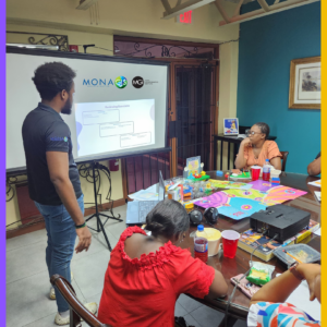
- Initial consultations with stakeholders in Negril and other regions of Jamaica.
- Inception reporting to document findings from the consultations.
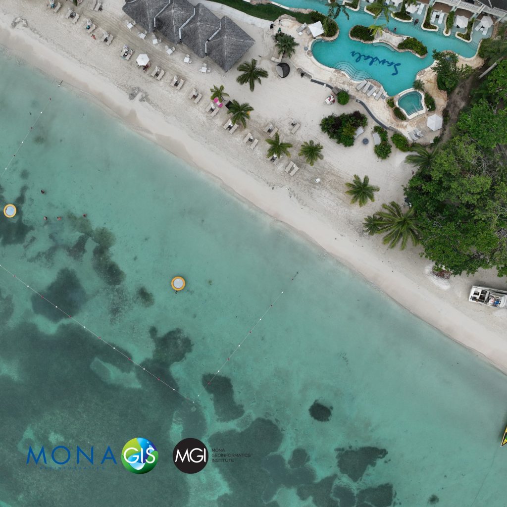
- UAV mapping of the Seven Mile Beach in Negril, involving site visits over several months.
- Drone image processing and analysis.
- Hosting an environmental seminar and media launch to share project findings.
- Developing a human-interest story highlighting the effects of shoreline erosion on Negril’s livelihoods.
- Final reporting and the creation of a Guidance Toolkit for coastal managers.


This project is funded by the Caribbean Catastrophe Risk Insurance Facility (CCRIF SPC) under the Small Grants Programme through the Office of Global Affairs (OGA) at The University of the West Indies.
For more information about the work we’re doing, please contact the Mona GeoInformatics Institute (MGI).
Email: info@monainformatixltd.com
Web: www.monagis.com
Phone: (876) 977-3161-2
WhatsApp: (876) 388-9097
#drone #uav #coastline #negril #jamaica #westmoreland #stakeholders #beach #mgi #monagis #fishermen #fishing #hotels #tourism #disaster #coastalprotection #beacherosion