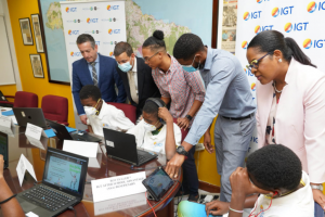
Fourth Staging of IGT’s Coding & Robotics Rock Camp 2024 to Kickoff on July 15, 2024
On Monday, July 15, 2024, the Mona GeoInformatics Institute (MGI) will launch the 4th staging of the IGT Coding and Robotics Rock! Camp 2024.This year,

MGI Collaborates with Missouri State University on Flood Risk Mapping Using Drones
The Mona GeoInformatics Institute (MGI) recently met with professors from Missouri State University in Treasure Beach, Jamaica, to learn more about their ongoing project aimed
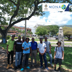
MGI’s Successful Collaborative Drone Training with FST, UWI Mona
The Mona Academy of Science and Technology (MAST) at the Faculty of Science and Technology (FST), UWI Mona and The Mona GeoInformatics Institute (MGI) Drone

Our friend and colleague Rafi Ahmad has passed away
We recently learned about the passing of Rafi Ahmad, a renowned geologist and former lecturer in the Department of Geography and Geology at The University
Fourth Staging of IGT’s Coding & Robotics Rock Camp 2024 to Kickoff on July 15, 2024
On Monday, July 15, 2024, the Mona GeoInformatics Institute (MGI) will launch the 4th staging of the IGT Coding and Robotics Rock! Camp 2024.This year,
MGI Collaborates with Missouri State University on Flood Risk Mapping Using Drones
The Mona GeoInformatics Institute (MGI) recently met with professors from Missouri State University in Treasure Beach, Jamaica, to learn more about their ongoing project aimed
MGI’s Successful Collaborative Drone Training with FST, UWI Mona
The Mona Academy of Science and Technology (MAST) at the Faculty of Science and Technology (FST), UWI Mona and The Mona GeoInformatics Institute (MGI) Drone
Our friend and colleague Rafi Ahmad has passed away
We recently learned about the passing of Rafi Ahmad, a renowned geologist and former lecturer in the Department of Geography and Geology at The University
Powering CORE-EIS, equipping nations to be resilient against climate change
Curating your journey with JAMNAV
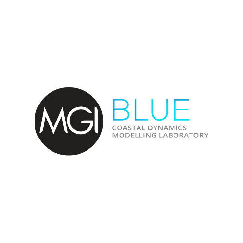
Coastal Zone Research Modelling & Management through MGI Blue
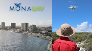
Providing insights through drone imagery and analysis


Powering CORE-EIS, equipping nations to be resilient against climate change
Curating your journey with JAMNAV
Coastal Zone Research Modelling & Management through MGI Blue
Providing insights through drone imagery and analysis