Site Suitability Desktop Analysis - Environmental & Hazard
Examples of input datasets: general soils and soils suitable for different crops, geology, farms, aquifers, alluvial plains, rivers, wells, springs, land use, mangroves, protected areas, urban areas, rainfall, wind, temperature, flooding, landslides etc.
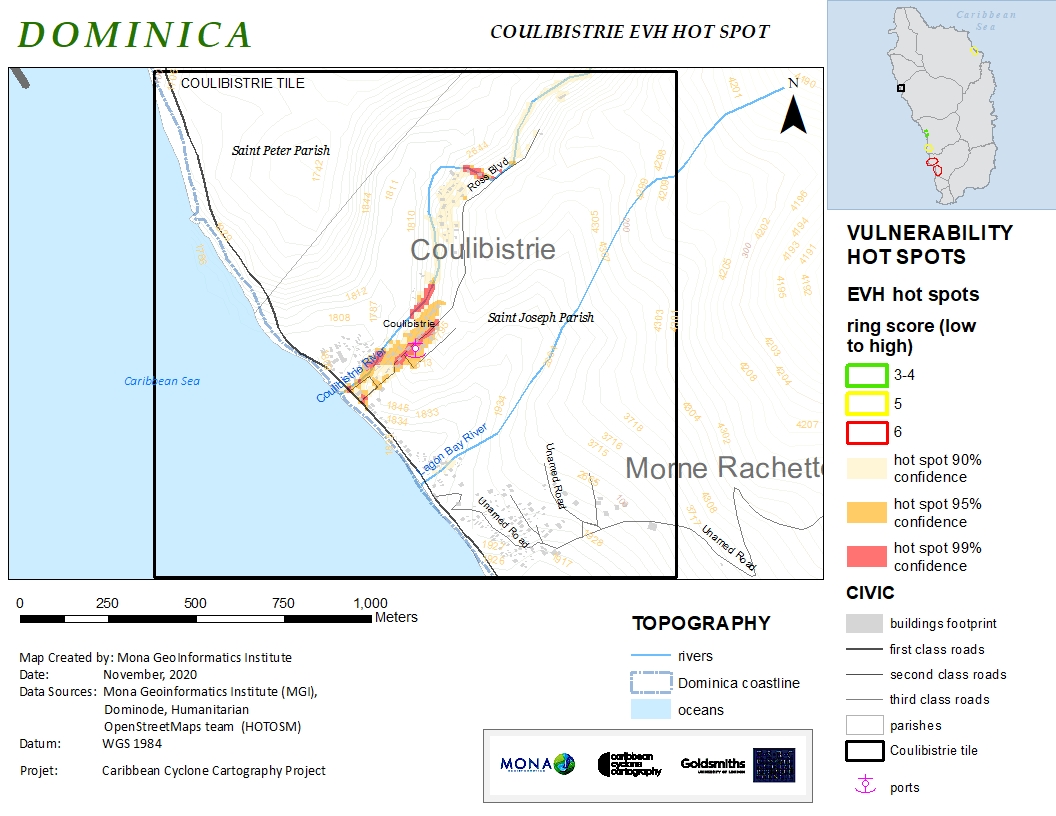
Overview: natural hazard analysis to include multiple hazard rating, sea level rise, storm surge, landslide rating & historical landslide distribution, flooding potential & historical inland flooding, wind data analysis (including historical storm tracks), earthquake data analysis (historical).
For general environmental analysis, MGI can conduct desktop analysis to include assessments of water resources, geology & geomorphology, land use, protected areas, forest reserves, coral reefs among others.